About the Book
If you want to be able to say that you know how to create a geological map from field work and if you would like to say that you can read and interpret a geological map, then all you have to do is read this book from beginning to end and then put it on your bookshelf where you can find it easily. That's all.
Many books on the subject of field mapping are simply too out of date to be useful. The classic books that can still be purchased second-hand from eBay were written half a century ago. Consequently, there is no mention within them of such things as digital cameras, GPS positioning systems, current map types, or any other modern matter. Actually, when you read them, you find that they are not really concentrating on the subject of mapping, but more on how to identify minerals and fossils in the field as a geologist needs to do. But that means that very few pages in those old books are actually dedicated to the subject of field mapping.
This book, written by a lifelong professional geologist and academic is different. It is up-to-date, describing the use of modern equipment and modern methods where relevant. It also describes how simple the process can be so that it can be used by amateurs of any age and young people who are about to start out on a university course studying geology for several years.
If you are either of these two categories of reader, you will be pleased to learn that this book is dedicated only to geological field mapping and takes you from 'step one' to a competent level to create field maps. Most importantly, it is written in a friendly and personal style, with diagrams drawn by and photographs taken by the author himself rather than being prepared by a professional artist or taken from other sources.
This book achieves its aim by assiduously following the circular tenet that you cannot create a geological map until you can read a geological map and you cannot read a geological map until you can create a geological map in the field. This sounds contradictory, but Dr Roberts learned long ago that it means that any successful book on this subject has to teach both aspects at the same time—map reading and field mapping. That's precisely what his book does; and much more.
This is arguably the most comprehensive book currently available on the subject. Yet it was not created for professionals, but for any beginner who will, incidentally, learn quite a lot about the general subject of geology while studying it.
CONTENTS
1. Introduction
2. Why do we need to do geological field mapping?
3. How do we go about doing geological field mapping?
3.1 Overview
3.2 Practical advice
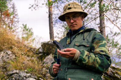
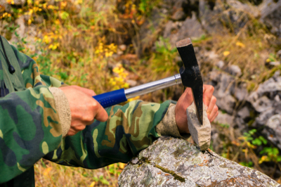
3.3 Equipment
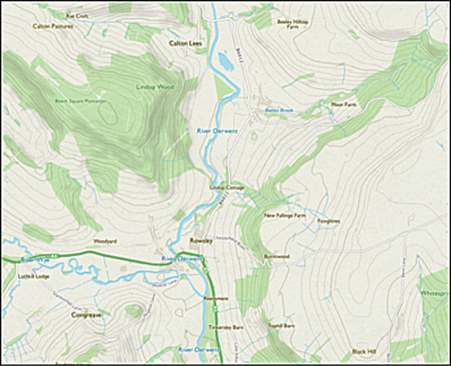
3.4 Ordnance Survey contour maps
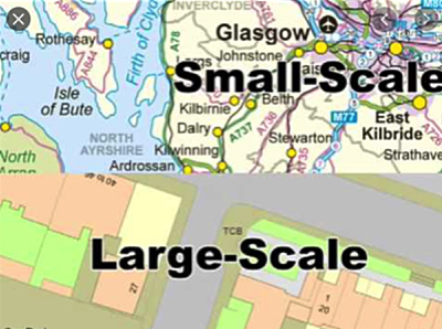
3.5 Scale of maps
3.6 The old County Series of maps
3.7 The current National Grid series of maps
4. How to understand and create geological maps
4.1 Introduction
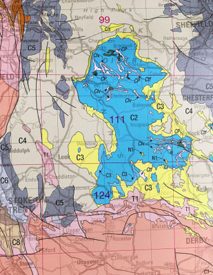
4.2 Nationally available geological maps
4.3 Preparing your own geological maps
5. Structure of the planet Earth and its various rock types for mapping
6. Fundamental rock types
6.1 Igneous intrusive rocks
6.2 Igneous extrusive rocks
6.3 Sedimentary rocks
6.4 Metamorphic rocks
7. Mapping igneous rocks
7.1 Plutonic rocks
7.2 Concordant minor intrusive rocks
7.3 Discordant minor intrusive rocks
7.4 Extrusive volcanic lava flows and ash rocks
8. Mapping sedimentary rocks
8.1 General considerations
8.2 Weathering
8.3 Modes of sedimentary strata failure
9. Mapping metamorphic rocks
9.1 Some relevant metamorphic rocks
9.2 Metamorphic processes
9.3 Rock recognition and appearances resulting from metamorphism
9.4 Rock identification in relation to minor intrusion metamorphisms
9.5 Rock instability in relation to major intrusion metamorphism
9.6 Further mapping implications
10. Dip and outcrop recognition
10.1 Field recognition
10.2 The concept of strike lines
10.3 Some simple strike lines to show the principles
10.4 Developing strike line maps from field outcrops
10.5 Developing our numerical use of strike lines
10.6 General outcrop patterns
11. The recording and analysis of dip data using stereographic projections
11.1 What are stereonets?
11.2 The representation of field data on stereonet plots
12. References
13. Bibliography
14. Geology Glossary
15. Appendix - The use of the camera and mobile telephone for site surveying
15.1 Use a digital camera or phone to create site records
15.2 Use a digital camera or phone to create site plans
Would you like to have all the knowledge that is in these 24 diagrams and photos, as well as in the other 160 diagrams and illustrations in my book?
If so, just buy it!
Rock Slope Engineering
Peter Roberts
Rock Face Stability
Rock Mechanics
Reinforced Soil
Stereonet
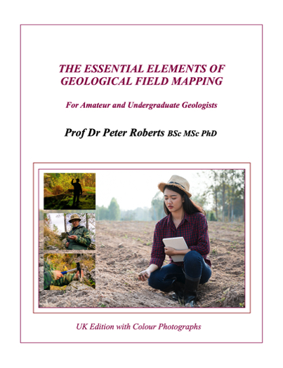
The Essential Elements of Geological Field Mapping
Prof Dr Peter Roberts
The Essential Elements of Geological Field Mapping
For Amateur and Undergraduate Geologists
Published by Russet Publishing 2021. 355 US Letter-sized pages.
£27.00 Supplied as a PDF book. No VAT, No postage, No packaging, No courier.
Three copies are downloaded for you. One each for any combination of desktop computer, laptop, and/or tablet. Three PDF files will be sent, locked to either your personal or your work email address for your security. See our TERMS for necessary details.
This modern book is written for amateur geologists and those studying for a geology degree and hoping to work in the fields of geotechnical, highways, and civil engineering, as well as in the mineral exploration and quarrying industries. It will also, no doubt, be useful for graduates who are in the early parts of their careers and who might benefit from a refresher in mapping.
The overall purpose of this book is to provide the individual with the real, practical, information and techniques that will provide the confidence to assess, plan, and undertake the preparation of geological maps on a day-to-day working basis.
The great majority of the diagrams are drawn by Peter Roberts himself, thus reducing possible artistic error through the re-drawing process. The book contains worked examples in the chapter on the use of stereonets for field work interpretation. Although capable of being used anywhere in the world, this book has been written primarily for use in the United Kingdom.
This book covers everything from what you need to buy to what you need to wear and how you actually go about doing your mapping. There is arguably no equally comprehensive, practical, or useful book available elsewhere.
ISBN 978-1-910537-42-8 Electronic UK Version.
THEY LIKED IT—SEE IF YOU LIKE IT BEFORE YOU BUY
THIS BOOK IS ONLY AVAILABLE FROM RUSSET PUBLISHING
High definition electronic PDF version. 3 for the price of 1.
You can download to any three devices of your choice. For example, your work computer, your personal PC/laptop, your tablet or your smartphone. It's up to you.
Buy directly from us at Russest Publishing
£27.00 VAT-free. (No P&P. No print and no postal delay.)
Add to cart and set quantity required on the cart page
For every one you order, we will send 3 for your personal use
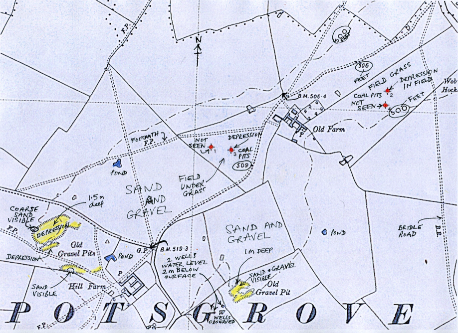
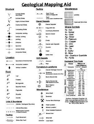
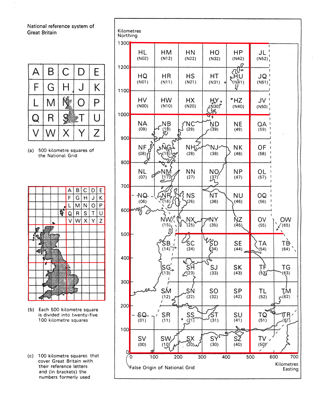
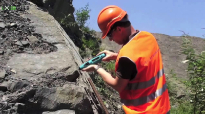
THESE ARE SOME OF THE 180+ FIGURES AND COLOURED PHOTOGRAPHS FROM THE BOOK
WHEN YOU BUY A TECHNICAL BOOK, YOU NEED TO KNOW EXACTLY WHAT IS IN IT AND WHAT YOU ARE BUYING.
SO, SCROLL DOWN AND READ ON:
By clicking "Add to Cart", you confirm that you have read and agreed to our terms of business and payment procedures.
Here are a few extracts from unsolicited reviews we have received:
I have now read your book from cover to cover and greatly enjoyed it, although I cannot say I am ready to create a stereographic projection just yet!! However, I have learnt a great deal and have listed the web-sites and made lots of notes for me to return to for further understanding.
I wish I had access to this book at the beginning of my career...
I had no difficulty in downloading the book.
Order 1 and get 3 downloads